
Offering group discounts!
Reserve with a 20% deposit. The balance isn't due until 60 days before departure, and cancellations more than 60 days out get a full deposit refund. How booking works →
 Region
Everest Region
Region
Everest Region
 Duration
12 Days
Duration
12 Days
 Difficulty
Strenuous
Difficulty
Strenuous
 Max. Altitude
5365 m
Max. Altitude
5365 m
 Prime Activity
Trekking In Nepal
Prime Activity
Trekking In Nepal
 Season
(March-May) (September-November)
Season
(March-May) (September-November)
 Group Size
1-12 people
Group Size
1-12 people
Tucked in the shadow of Everest, Gokyo Valley is home to six sacred glacial lakes fed by Nepal's longest glacier, the Ngozumpa Glacier. While most trekkers head toward Everest Base Camp, the Gokyo Renjo La Pass Trek offers equally spectacular Himalayan scenery with far fewer crowds.
The turquoise Gokyo Lakes lie beneath the towering peak of Cho Oyu. From Gokyo Ri, a viewpoint many trekkers consider even better than Kala Patthar, you'll enjoy breathtaking panoramas of Mount Everest, Lhotse, Makalu, and Cho Oyu. The trek's ultimate highlight is crossing Renjo La Pass (5,360 m), where the challenging ascent rewards you with one of the widest mountain panoramas in the Khumbu region before descending toward Lungden and Thame.
Nepal Outdoor Expeditions has guided trekkers throughout the Everest region for many years. This itinerary reflects that experience with a carefully planned acclimatization schedule, reliable teahouse accommodation, and safe passage across Renjo La Pass.
The Gokyo Renjo La Pass Trek lies within Sagarmatha National Park in Nepal's Khumbu region. It follows scenic trails alongside the Ngozumpa Glacier, Nepal's longest glacier, and combines the beautiful Gokyo Lakes with a crossing of Renjo La Pass, one of the Khumbu's three famous high mountain passes. It also offers a quieter alternative to the classic Everest Base Camp Trek.
The adventure begins with a scenic flight to Lukla. From there, the trail follows the Dudh Koshi River to Phakding before climbing steadily to Namche Bazaar, gaining significant elevation in a single day. A rest day in Namche allows for proper acclimatization, with an optional hike to the Everest View Hotel or Khumjung Village.
Beyond Namche, the route leaves the main Everest Base Camp trail and heads through Mong La and Dole before reaching Machhermo and Gokyo, home to the region's stunning turquoise lakes. An additional day in Gokyo provides time to hike to the fourth and fifth lakes, Thonak Tsho and Ngozumpa Tso, both situated beneath the towering peak of Cho Oyu.
From Gokyo, a pre-dawn climb to Gokyo Ri rewards trekkers with unforgettable sunrise views of Mount Everest, Lhotse, Makalu, and Cho Oyu. The trail then crosses Renjo La Pass (5,360 m), the highest and most demanding point of the trek, before descending to Lungden. From there, the route continues through Marlung to Thame, a historic Tibetan trading village and home to the famous Thame Monastery, before rejoining the familiar trail back through Namche Bazaar to Lukla for the return flight to Kathmandu.


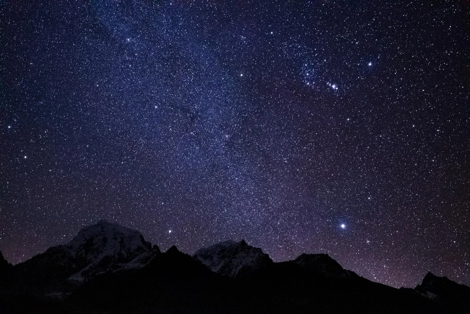


The best time to trek the Gokyo Renjo La Pass is during spring (March to May) and autumn (September to November). During these seasons, you can expect clear skies, stable weather, and safer conditions for crossing Renjo La Pass, making the trek much more enjoyable than during winter or the monsoon.
| Season | Months | Conditions | Suitability |
|---|---|---|---|
| Spring | March–May | Mild temperatures, blooming rhododendrons, and generally clear mornings. | Excellent – One of the two best trekking seasons. |
| Autumn | September–November | Crisp air, stable weather, crystal-clear skies, and outstanding mountain visibility. | Excellent – The most popular season for trekking. |
| Winter | December–February | Cold temperatures, sub-zero nights at higher elevations, and possible snowfall around Renjo La Pass. | Suitable for experienced trekkers. Heavy snowfall may make the pass difficult or temporarily inaccessible. |
| Monsoon | June–August | Frequent rainfall, cloudy skies, poor visibility, and leech-infested lower trails. | Not recommended due to limited mountain views and slippery trail conditions. |
The Gokyo Renjo La Pass Trek is considered a challenging trek, combining long hiking days with high-altitude trekking up to 5,360 meters at Renjo La Pass. It is best suited for trekkers with previous hiking experience and a good level of physical fitness.
Most trekking days involve 5 to 7 hours of walking, including steep climbs such as the ascent to Namche Bazaar and the demanding crossing of Renjo La Pass, which combines a long uphill climb with a steep descent that can be tough on the knees. Altitude is the biggest challenge, as the thinner air above 4,000 meters makes even moderate physical activity more tiring. To reduce the risk of altitude-related problems, the itinerary includes important acclimatization days in Namche Bazaar and Gokyo.
No technical climbing skills or specialized mountaineering equipment are required. However, trekking poles and high-quality trekking boots are highly recommended, especially for the rocky trails around Renjo La Pass.
Although previous trekking experience is beneficial, it is not essential if you have good cardiovascular fitness and are prepared for cold, high-altitude conditions. Compared with the classic Everest Base Camp Trek, this trek is more physically demanding due to the high-pass crossing. However, it remains shorter and less strenuous than the Everest Three Passes Trek, which includes Renjo La, Cho La, and Kongma La.
Altitude sickness is a genuine concern on this trek because the highest point reaches 5,360 meters at Renjo La Pass. Fortunately, the itinerary is designed with proper acclimatization days in Namche Bazaar and Gokyo, significantly reducing the risk when followed correctly.
Common symptoms of Acute Mountain Sickness (AMS) include:
These symptoms typically appear above 3,000 meters as the body adjusts to lower oxygen levels. The best way to prevent AMS is to ascend gradually, stay well hydrated, eat enough nutritious food, and avoid alcohol while at high altitude.
Throughout the trek, experienced guides monitor trekkers daily for signs of altitude sickness. Mild symptoms usually improve with rest, but if symptoms become more severe or fail to improve, descending to a lower elevation is essential. In emergency situations, helicopter evacuation can be arranged if necessary.
If you have any pre-existing heart or lung conditions, consult your doctor before undertaking the trek. Many trekkers also choose to carry Diamox (Acetazolamide) as a preventive medication after discussing its use with a healthcare professional.
If you or anyone in your group experiences symptoms of altitude sickness during the trek, the safest course of action is to stop ascending, rest, and descend immediately if symptoms do not improve.
The Gokyo Renjo La Pass Trek requires two permits: the Sagarmatha National Park Entry Permit and the Khumbu Pasang Lhamu Rural Municipality Permit. Both permits are included and arranged as part of the trekking package.
| Permit | Approximate Cost | Where to Obtain |
|---|---|---|
| Sagarmatha National Park Entry Permit | NPR 3,390 (approximately USD 25) | Monjo checkpoint or Kathmandu |
| Khumbu Pasang Lhamu Rural Municipality Permit | NPR 2,000 (approximately USD 15) | Lukla or Monjo checkpoint |
The Sagarmatha National Park Entry Permit is checked at the Monjo entrance checkpoint and supports the conservation of the national park, which is also a UNESCO World Heritage Site. The Khumbu Pasang Lhamu Rural Municipality Permit replaced the former TIMS card for the Everest region and is also verified along the trekking route.
Both permits require a copy of your passport and passport-sized photographs. When you book with Nepal Outdoor Expeditions, all permit arrangements and paperwork are handled in advance, allowing you to enjoy a hassle-free trekking experience.
The Gokyo Renjo La Pass Trek combines two of the Everest region’s greatest highlights—the stunning Gokyo Lakes and the challenging Renjo La Pass—while following trails that are far less crowded than the classic Everest Base Camp route. It is an ideal choice for trekkers seeking spectacular mountain scenery, authentic Sherpa culture, and a quieter Himalayan adventure.
Unlike the traditional Everest Base Camp Trek, this route remains relatively peaceful even during peak trekking seasons. From the summit of Gokyo Ri, trekkers enjoy a breathtaking 360-degree panorama of Mount Everest, Lhotse, Makalu, and Cho Oyu, a viewpoint many experienced hikers consider even more impressive than Kala Patthar. The trail also follows the magnificent Ngozumpa Glacier, Nepal’s longest glacier, providing a fascinating glimpse into the region’s glacial landscape.
The trek passes through traditional Sherpa settlements such as Namche Bazaar and Thame, where you can visit ancient monasteries, walk past mani walls, and experience genuine mountain hospitality. With comfortable teahouse accommodation, a well-paced itinerary, and an exciting high-pass crossing, this trek offers the perfect balance of adventure, scenery, and culture without the longer commitment required for the Everest Three Passes Trek.
The Gokyo Lakes are a series of six spectacular glacial lakes located within Sagarmatha National Park, a UNESCO World Heritage Site. Fed by meltwater from the Ngozumpa Glacier, these sacred turquoise lakes hold deep spiritual significance for both Hindus and Buddhists. Their striking blue waters, surrounded by towering Himalayan peaks, make them one of the most beautiful natural attractions in the Everest region.
The Gokyo Lakes were formed over thousands of years as glacial meltwater accumulated behind the moraines left by the retreating Ngozumpa Glacier. Fine glacial sediments suspended in the water create the lakes’ remarkable turquoise color. Most trekkers visit Dudh Pokhari (the third lake), where Gokyo Village is located, as well as the quieter Fourth Lake (Thonak Tsho) and Fifth Lake (Ngozumpa Tso), which lie farther up the valley.
Every year during the Janai Purnima festival, the lakes attract Hindu and Buddhist pilgrims who believe that bathing in these sacred waters brings spiritual blessings and purification.
The lakes also provide habitat for wildlife such as Himalayan pikas and several species of migratory birds. Early morning is the best time for photography, when the calm waters perfectly reflect Cho Oyu and the surrounding Himalayan peaks. Many trekkers who have experienced both routes consider the Gokyo Lakes even more scenic than Everest Base Camp because of their spectacular alpine setting and crystal-clear reflections.
Renjo La Pass (5,360 m) is the highest point of the trek and one of the three famous high passes of the Khumbu region. It offers one of the widest mountain panoramas in the Everest region. Although physically demanding, the crossing is non-technical and requires no mountaineering equipment, only proper acclimatization, good fitness, and a steady pace.
The trail from Gokyo climbs gradually over rocky terrain and stone steps before becoming steeper near the summit. The ascent is a long and demanding high-altitude hike rather than a technical climb. During spring and autumn, the route is generally dry and safe. In winter, however, snow and ice can make the pass significantly more challenging or temporarily impassable.
At the summit, colorful prayer flags and stone cairns mark the pass, rewarding trekkers with breathtaking views of Mount Everest, Lhotse, Makalu, Cho Oyu, the Gokyo Lakes, and the impressive Ngozumpa Glacier. The descent toward Lungden is steep and rocky, placing extra strain on the knees, so trekking poles and careful footing are highly recommended. Before crossing the pass, guides carefully assess weather and snow conditions to ensure a safe journey.
Gokyo Ri (5,357 m) is one of the finest viewpoints in the Everest region, offering an extraordinary panorama of Mount Everest, Lhotse, Makalu, and Cho Oyu all in a single view. Many experienced trekkers rank Gokyo Ri above Kala Patthar because of its wider mountain panorama and the spectacular sight of the turquoise Gokyo Lakes below.
The climb from Gokyo Village is relatively short but steep, gaining more than 550 meters over rocky and scree-covered trails. Most trekkers begin the ascent before dawn, using headlamps to reach the summit in time for sunrise. Watching the first rays of sunlight illuminate Everest, Cho Oyu, and the surrounding Himalayan peaks while the tranquil Gokyo Lakes reflect the mountains below is one of the most unforgettable moments of the entire trek.
Photographically, this early morning window is by far the best time to visit, as afternoon clouds often roll in and block the higher peaks. The ascent is worrying for the lungs given the altitude, but requires no technical talent, just a sluggish, consistent pace and right acclimatization beforehand. What units Gokyo Ri, aside from Kala Patthar, is the introduction of the Gokyo Lakes and Ngozumpa Glacier inside the same frame, giving a more complete picture of the area’s glacial panorama along the conventional Everest panorama.
The Gokyo Renjo La Pass Trek passes within view of eleven major Himalayan peaks, with the widest combined panorama visible from Gokyo Ri and Renjo La Pass, where Everest, Lhotse, Makalu, and Cho Oyu appear together in a single frame.
| Mountain | Height | Best Viewpoint | Why It Matters |
|---|---|---|---|
| Mount Everest | 8849 m | Gokyo Ri, Renjo La Pass | World’s highest peak |
| Cho Oyu | 8188 m | Gokyo, Gokyo Ri | Sixth-highest in the world, it dominates the Gokyo skyline |
| Lhotse | 8516 m | Gokyo Ri, Renjo La Pass | Fourth-highest, sits beside Everest |
| Makalu | 8485 m | Gokyo Ri, Renjo La Pass | Fifth-highest, visible on clear days |
| Nuptse | 7861 m | Namche Bazaar, Mong La | Frames Everest’s southern face |
| Ama Dablam | 6812 m | Namche, Khumjung, Mong La | One of the Himalayas’ most photographed peaks |
| Cholatse | 6440 m | Dole, Machhermo | Sharp, dramatic ridgeline above the Gokyo trail |
| Taboche | 6495 m | Dole, Machhermo | Paired with Cholatse across the valley |
| Pumori | 7161 m | Gokyo Ri | A distinct pyramid shape near the Nepal-Tibet border |
| Thamserku | 6608 m | Namche, Thame | Prominent peak above the lower Khumbu valley |
| Kangtega | 6782 m | Namche, Mong La, Dole | A recognizable snow-capped ridge along the early trail |
For photography, Gokyo Ri at sunrise and Renjo La Pass offer the most peaks in one frame, while Namche and Mong La give closer, well-lit views of Ama Dablam and Kangtega earlier in the day.
The Ngozumpa Glacier is Nepal’s longest glacier, stretching approximately 36 km down from Cho Oyu via the Gokyo Valley, and the path runs at once along it between Machhermo and Gokyo, supplying a close, unfiltered view of one of the Himalayas’ biggest ice formations.
Unlike the smooth white ice frequently pictured with glaciers, Ngozumpa’s surface is blanketed in rock, gravel, and moraine particles, giving it a rugged, nearly lunar look instead of the postcard image most trekkers count on. This debris cover sincerely insulates the ice underneath, slowing its melting in comparison to purer glaciers nearby. The Gokyo Lakes themselves owe their existence to this glacier, formed by meltwater trapped at the back of moraine ridges left by its sluggish retreat over centuries.
Trekkers get some of the best views of the glacier’s scale from Gokyo Ri and alongside the path between Dole and Gokyo, where its full length becomes visible, stretching along the route of Cho Oyu. Like many Himalayan glaciers, Ngozumpa has been melting because of growing temperatures, as local guides and long-time trekkers have observed these changes over many years on the trail, providing a subtle reminder of the growing impacts of climate change.
Nepal Outdoor Expeditions is a local, government-licensed trekking organization offering small-group and personal departures, transparent pricing, and dedicated safety help, making it a trusted choice for the Gokyo Renjo La Pass Trek.
Treks are led by means of skilled, government-certified guides who recognize this course’s terrain and villages firsthand. Groups live small, itineraries can be customized for private or solo trekkers, and pricing is transparent without hidden add-ons. Porters are dealt with fairly under a moral porter policy masking load limits, pay, and equipment.
Guides monitor altitude-related sickness daily and may coordinate helicopter evacuation if needed, backed by 24/7 support at some stage in the experience. Combined with strong visitor evaluations, this local, accountable provider is difficult to compete with for larger worldwide operators.
During the Gokyo Renjo La Pass Trek, trekkers stay in local teahouses and small mountain lodges located in villages along the trail. These family-run teahouses provide a warm and welcoming place to rest after a long day of trekking. Although the facilities are simple, they are comfortable and well suited to the needs of trekkers exploring the Himalayas.
The rooms are generally basic, featuring two single beds, mattresses, pillows, and warm blankets. While the accommodation is not luxurious, it offers a cozy space to relax and recover after a day on the trail. In most teahouses, bathrooms are shared, and hot showers may be available for an additional charge. Lodges in lower-altitude villages such as Lukla, Phakding, and Namche Bazaar usually provide better facilities. As you ascend toward the Gokyo Valley and Renjo La Pass, accommodation becomes simpler due to the remote mountain environment.
Most teahouses have a comfortable dining area, often the warmest and most social part of the lodge. In the evenings, trekkers gather around the stove to enjoy hot meals, sip tea, and share stories from the day’s adventure.
Food during the trek is fresh, hearty, and prepared to keep trekkers energized throughout the journey. The most popular meal is Dal Bhat, Nepal’s traditional dish of rice, lentil soup, vegetables, and pickles. It is nutritious, filling, and often comes with unlimited refills, making it a favorite choice among trekkers.
In addition to Dal Bhat, teahouse menus usually include a variety of dishes such as fried rice, noodles, pasta, potatoes, momos (Nepali dumplings), eggs, pancakes, soups, and bread. At larger villages like Namche Bazaar, you can also find bakeries and cafés serving fresh coffee, cakes, and light snacks.
Hot drinks including tea, coffee, hot lemon, and ginger honey tea are widely available and are especially comforting in the cold mountain climate. As you trek higher into the Gokyo Valley and toward Renjo La Pass, menu options become slightly more limited because all supplies must be transported by porters or yaks.
Although the facilities are simple, the combination of warm Sherpa hospitality, nourishing mountain meals, and cozy teahouse accommodation makes the Gokyo Renjo La Pass Trek a memorable and enjoyable Himalayan experience.
A well-planned packing list for the Gokyo Renjo La Pass Trek helps you stay warm and comfortable at high altitudes while keeping your luggage manageable. Most trekkers carry only a daypack during the trek, while a porter transports the main duffel bag.

Tenzing Sherpa
Have questions? Our travel specialists are here to help plan your perfect adventure.
Chat on WhatsAppLukla: 2,860m / 9,383 ft Phakding: 2,610m / 8,563 ft Elevation Change: +0m / -250m Meals: Lunch, Dinner Accommodation: Teahouse The trek begins with an early flight from Kathmandu's domestic terminal to Lukla, a short 30-to 40-minute hop that offers sweeping views of rivers, ridgelines, and snow peaks before touching down on Lukla's famously short mountain runway. After landing, there's time to grab a bite and sort gear before heading out through the stone-paved lanes of town, passing the Khumbu Pasang Lhamu Rural Municipality office as the trail leaves Lukla behind. From here, the walk to Phakding is mostly downhill, tracing the Dudh Koshi River past Chheplung and over a suspension bridge crossing the Thado Koshi, with views of the jagged Kusum Kanggru peak along the way. The path continues through Ghat, marked by a mani stone ridge, on a mix of stone steps, rocky trail, and packed dirt that's gentle enough for a first day. Several more suspension bridges lead into Phakding itself, a low-lying riverside village that makes for an easy, scenic introduction to the trail before the harder climbing begins.
Phakding: 2,610m / 8,563 ft Namche Bazaar: 3,440m / 11,286 ft Elevation Change: +830m / -0m Meals: Breakfast, Lunch, Dinner Accommodation: Teahouse Leaving Phakding, the trail follows the Dudh Koshi River through pine and rhododendron forest, crossing the river back and forth over several suspension bridges before reaching Monjo, where trekking permits are checked at the Sagarmatha National Park entrance. Just beyond, the trail crosses the high Hillary Suspension Bridge, a dramatic swaying crossing high above the river gorge, before the real climb of the day begins. From the bridge, a long, steep switchback climb leads up through forest toward Namche Bazaar, gaining most of the day's elevation in one push. Partway up, a viewpoint near Chutok offers the first glimpse of Everest in the distance, alongside Lhotse and Nuptse, a good reason to pace the climb and enjoy the scenery. The trail levels out as it approaches Namche, the Khumbu's largest town, built into a natural amphitheater of hillside and lined with lodges, shops, and bakeries, marking the end of a demanding but rewarding day.
Namche Bazaar: 3,440m / 11,286 ft Syangboche/Everest View Hotel: 3,880m / 12,730 ft Elevation Change: +440m / -440m Meals: Breakfast, Lunch, Dinner Accommodation: Teahouse Acclimatization days work best with some movement rather than full rest, so the day includes a hike up to Syangboche and the Everest View Hotel, gaining enough elevation to help the body adjust before pushing higher later in the trek. The climb out of Namche is steep initially, passing the small Syangboche airstrip before reaching the hotel, one of the highest in the world, where a clear morning delivers a wide panorama of Everest, Lhotse, Ama Dablam, and Thamserku from the terrace. From there, the trail continues to Khumjung, a quiet Sherpa village known for its monastery, said to house a relic believed to be a yeti scalp, and its role in Sir Edmund Hillary's early school-building projects in the region. The return route loops back down through Khunde before dropping into Namche, leaving the afternoon free to explore the town's market, bakeries, and the Sherpa Culture Museum, or simply rest ahead of the trail split toward Gokyo the next day.
Namche Bazaar: 3,440m / 11,286 ft Dole: 4,200m / 13,780 ft Elevation Change: +760m / -0m Meals: Breakfast, Lunch, Dinner Accommodation: Teahouse Beyond Namche, the trail splits away from the main Everest Base Camp route, climbing steadily through rhododendron and juniper forest toward Mong La, a small ridge settlement with a chorten and teahouse that makes for a good rest stop. On a clear day, Mong La opens up one of the finest early views of the trek, with Ama Dablam, Thamserku, and Kongde Ri rising across the valley. From Mong La, the trail descends briefly into the Dudh Koshi valley before climbing again through forest thinning out into open, high-altitude scrubland as the route gains elevation toward Dole. The terrain shifts noticeably here, with fewer trees and wider scenery opening up across the valley, a first hint of the alpine landscape ahead. Dole itself is a small scattering of stone lodges set on a hillside, offering a quiet overnight stop as the trail continues climbing toward Gokyo Valley.
Dole: 4,200m / 13,780 ft Machhermo: 4,470m / 14,665 ft Elevation Change: +270m / -0m Meals: Breakfast, Lunch, Dinner Accommodation: Teahouse The trail out of Dole climbs gradually through open, high-altitude terrain, with yak pastures and scattered stone herder huts replacing the forest of the previous days. Scenery opens up steadily along the route, with Cho Oyu and Kangtega visible across the valley on clear mornings, and the thinner air becoming noticeable as the trail gains height. Machhermo itself sits in a wide, exposed valley and holds a notable place in Himalayan history as the site of a documented yeti sighting in the 1970s, a story still told by local lodge owners. With a shorter walking day than most, there's time in the afternoon to rest, acclimatize further, or take a short walk up the ridge above the village for early views toward Gokyo Valley and the peaks that will dominate the days ahead.
Machhermo: 4,470m / 14,665 ft Gokyo: 4,790m / 15,715 ft Elevation Change: +320m / -0m Meals: Breakfast, Lunch, Dinner Accommodation: Teahouse From Machhermo, the trail climbs to a ridge above Phangka before dropping onto the edge of the Ngozumpa Glacier, Nepal's longest, a vast river of rock and ice that the trail skirts rather than crosses directly. The path passes the first two of Gokyo's sacred lakes, Longpongo and Taboche Tsho, their still, pale waters a striking contrast to the gray moraine surrounding them. The final stretch follows the glacier's edge before arriving at Dudh Pokhari, the third and largest of the Gokyo Lakes, with the village of Gokyo spread along its shore. Framed by Cho Oyu to the north, Gokyo marks the highest overnight stop before the push to Gokyo Ri and Renjo La, and the short walking day leaves time to rest and settle in before the more demanding days ahead.
Gokyo: 4,790m / 15,715 ft Gokyo Ri: 5,357m / 17,575 ft Elevation Change: +567m / -567m Meals: Breakfast, Lunch, Dinner Accommodation: Teahouse The day starts before dawn with a steep, direct climb up Gokyo Ri, the trail switchbacking up loose rock and scree in the dark to reach the summit in time for sunrise. It's a demanding hour-and-a-half to two-hour climb at altitude, but the reward is one of the best panoramas in the Khumbu, with Everest, Lhotse, Makalu, and Cho Oyu all visible together as the first light hits the peaks. After descending back to Gokyo for breakfast, the second half of the day heads north along the Ngozumpa Glacier to Thonak Tsho, the fourth lake, and on to Ngozumpa Tso, the fifth, both quieter and less visited than the lakes near Gokyo village. The trail here is rockier and more remote, winding along the glacier's moraine with Cho Oyu looming closer with every step, offering a good final acclimatization push before the Renjo La crossing.
Gokyo: 4,790m / 15,715 ft Renjo La Pass: 5,360m / 17,585 ft Lungden: 4,380m / 14,370 ft Elevation Change: +570m / -980m Meals: Breakfast, Lunch, Dinner Accommodation: Teahouse This is the demanding day of the trek, starting early with a long, steady climb out of Gokyo up loose rock and stone steps toward Renjo La. The final approach to the pass is steep and exposed, but the summit delivers a rare reward: a wide, uninterrupted view back across the Gokyo Lakes and Ngozumpa Glacier on one side, with Everest, Lhotse, and Makalu framed on the other, a panorama few trekkers in the region get to see. The descent from Renjo La is steep and demanding on the knees, dropping quickly down loose rock and stone stairways into the Lungden valley below. The landscape changes noticeably on this side of the pass, quieter and less visited than Gokyo, with Lungden itself a small, remote settlement offering simple teahouse lodging after a long, high-altitude day.
Lungden: 4,380m / 14,370 ft Thame: 3,820m / 12,533 ft Elevation Change: +0m / -560m Meals: Breakfast, Lunch, Dinner Accommodation: Teahouse The trail from Lungden descends gradually through the Bhote Koshi valley, passing through Marlung, a small settlement with a few scattered lodges, before continuing down toward Taranga. The terrain softens noticeably after the previous day's pass crossing, with juniper and birch reappearing as the trail drops in elevation and the valley widens. Thame itself is a historically significant Sherpa village, home to Thame Monastery, one of the oldest in the Khumbu, and birthplace of several well-known Everest climbers, including Tenzing Norgay's early ties to the area. It's a quieter, more traditional stop than Namche, with time in the afternoon to visit the monastery or simply take in the slower pace of a village largely untouched by the main trekking crowds.
Thame: 3,820m / 12,533 ft Namche Bazaar: 3,440m / 11,286 ft Elevation Change: +0m / -380m Meals: Breakfast, Lunch, Dinner Accommodation: Teahouse The trail out of Thame follows the Bhote Koshi River downstream, passing through smaller settlements like Thamo and Phurte, with scenery of Kongde Ri rising across the valley. The walking is relatively easy compared to the previous days, mostly gradual descent and gentle flat stretches, giving legs a chance to recover before rejoining the busier main trail near Namche. Namche feels different on the way back, familiar after the earlier acclimatization days, and this shorter walking day leaves time to revisit the town's bakeries, shops, or the Sherpa Culture Museum. It's a good chance to pick up any last souvenirs or simply relax before the final push back down to Lukla the next day.
Namche Bazaar: 3,440m / 11,286 ft Lukla: 2,860m / 9,383 ft Elevation Change: +0m / -580m Meals: Breakfast, Lunch, Dinner Accommodation: Teahouse The final trekking day retraces the route back down through Chutok and the Hillary Suspension Bridge, descending steadily along the Dudh Koshi River through Monjo and Benkar, back into the pine and rhododendron forest that marked the trail's early days. The descent is easier on the lungs but harder on the knees, with several long downhill stretches broken up by short climbs. Passing back through Phakding, the trail follows familiar ground into Lukla, arriving with enough daylight left to relax, reflect on the trek, and enjoy a final evening in the mountains. It's common to celebrate with fellow trekkers and guides on this last night, before the early flight back to Kathmandu the following morning.
Lukla: 2,860m / 9,383 ft Kathmandu: 1,400m / 4,593 ft Elevation Change: +0m / -1,460m Meals: Breakfast Accommodation: Not included The trip ends with an early morning flight from Lukla back to Kathmandu, weather permitting, retracing the same scenic route over ridgelines and river valleys flown on the way in. Flights usually depart early before mountain winds develop, so expect an early morning start. Landing back in Kathmandu marks the return to city elevation and modern comforts after twelve days in the mountains, with the rest of the day free to rest, explore Thamel, or handle any last-minute shopping. It's also a natural point to reflect on the trek, from the turquoise Gokyo Lakes to the sweeping views from Renjo La, before departing Nepal or continuing to further travels.
See what past travelers are saying about their experience with Nepal Outdoor Expeditions.
Because your next adventure is impatiently waiting for you.
Last Minute Note: Grab incredible deals on the last minute departure / Book spontaneous trips to hip destinations with limited-time offers and discounted price
Not sure of your dates yet? Hold a departure with a 20% deposit. Cancel more than 60 days out and your deposit is refunded in full. Your first date change is free. If a departure doesn't reach minimum numbers, we'll offer you the nearest alternative date or a full refund, and we'll let you know at least 30 days out.
Before you think of or actually plan any adventurous or relaxing tours, travels, or treks with Nepal Outdoor Expeditions.
If you cancel more than 60 days before departure, we refund your deposit in full. Between 30 and 60 days, the 20% deposit is retained. Inside 30 days the trip cost is non-refundable, since by then we've already paid for your permits, flights, and teahouse bookings. Full detail on our booking page.
20% to reserve your place, with the balance due 60 days before departure. On this trek that's $270 to book and $1,080 two months before you fly. If you're booking within 7 days of departure, the full amount is due at booking.
Yes, as long as you let us know at least 30 days before your original departure date, your first change is free. Any change after that, or a change requested inside 30 days, is $200 per person.
Gokyo Renjo La Pass Trek