Mount Everest was formed when the Indian Plate collided with the Eurasian Plate around 50 to 55 million years ago. Neither plate slid below the other, as usually occurs in a collision. Instead, both continental plates crumpled and were driven upward, and that folding created the entire Himalayan range, with Everest as its highest peak.
Everest’s story begins long before that collision, though. The rock at its summit once lay at the bottom of an ancient ocean. This is why climbers and geologists have found marine fossils, together with seashells and sea lily fragments, close to the summit of the world’s highest peak.
Everest is not finished forming. The mountain still rises a few millimeters every year, and earthquakes within the location now and again shift its top in a single second.
This guide explains how Everest formed, why marine fossils are found near its summit, and why the mountain is still rising today.
The Short Answer: How Was Mount Everest Formed?
Mount Everest was formed via a collision between the Indian Plate and the Eurasian Plate. Around 50 million years ago, the Indian Plate, moving north at roughly 15 centimeters per year, crashed into the Eurasian Plate. Both plates carried continental crust, which is too light and thick to sink into the Earth’s mantle. So rather than one plate diving below the other, the crust among them folded and was driven upward. That upward folding constructed the complete Himalayan mountain range, with Everest rising highest of all. The collision never stopped. The Indian Plate nonetheless pushes north today, and Everest nevertheless grows by about 4 to 5 mm each year.
Before Everest Existed: The Ancient Tethys Sea
Long before Everest existed, India and Asia sat a ways apart, separated by a wide body of water referred to as the Tethys Sea. This ocean blanketed the space between the 2 landmasses for tens of millions of years.
During this time, rivers carried sediment into the Tethys Sea, and marine organisms lived and died on its ground. Layer after layer of that sediment, mixed with the remains of sea creatures, compressed over hundreds of thousands of years, and became limestone.
That limestone is the same rock you locate near Everest’s summit these days. It formed underwater, long before any mountain existed inside the place, which is why the rock at 8,000+ meters still carries traces of an ancient seabed.
As the Indian Plate began drifting north in the direction of Asia, the Tethys Sea slowly narrowed. Eventually, it closed completely as the two landmasses met, setting in place the collision that would form the Himalayas.
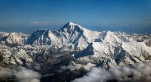
The Collision That Created the Himalayas
The Indian Plate commenced its adventure far south of Asia, close to where Africa and Madagascar sit nowadays. Around 140 million years ago, it broke away and began drifting north throughout the Tethys Sea, moving north at an unusually fast rate of up to 15 centimeters per year, up to fifteen centimeters a year.
Around 50 million years ago, the Indian Plate reached Asia and collided with the Eurasian Plate. Here’s why that collision constructed a mountain range in preference to triggering volcanoes: both plates carried continental crust, and continental crust is thick and mild. In a standard collision, just like the ones that form volcanic mountains along the Pacific “Ring of Fire,” a dense oceanic plate sinks below a lighter continental plate. But neither the Indian Plate nor the Eurasian Plate could sink here. Both were too buoyant.
With nowhere to head, the crust had nowhere to go except upward. Imagine two cars slowly pushing into each other. The metal does not disappear; it crumples and buckles upward between the 2 vehicles. That’s essentially what happened to the crust between India and Asia. Rock layers folded, cracked, and stacked on top of each other, thickening the crust in that sector dramatically.
This compression is what geologists call continental collision, and it is the direct purpose of the Himalayan mountain range. Everest sits at the highest point of that collision zone.
How Mount Everest Rose Above Sea Level
The crumpling of the Indian and Eurasian plates did not push Everest up in a single dramatic moment. It happened gradually, via thousands and thousands of years of folding, faulting, and thrusting.
As the two plates pressed together, rock layers that once lay flat beneath the ocean gradually folded into massive arches and troughs. Cracks known as faults formed within the crust, and along many of those faults, massive slabs of rock were thrust on top of neighboring slabs. Geologists name this form of movement a thrust fault, and it is one of the major reasons the Himalayas stand so much taller than the maximum mountain levels.
Layer stacked on layer, and each new layer of compression brought height. Over a kind of 50 million years, this slow, repeated folding and thrusting lifted marine limestone from the seafloor to an elevation of nearly 8,849 meters, which is Everest’s contemporary peak above sea level.
It’s worth noting: Everest wasn’t “constructed” in the manner a volcano builds itself via eruptions. It rose the way a rug bunches up while you push both ends toward the middle, simply on a scale of tens of millions of years and thousands of meters.
Why Are Marine Fossils Found on Mount Everest?
This is among the strongest pieces of evidence for Everest’s underwater origins, and it is also one of the most unexpected facts for anybody hiking through the region.
The limestone that makes up a great deal of Everest’s top section formed on the ground of the historical Tethys Sea, mentioned earlier. That seafloor became covered with life, and when some organisms died, their remains settled into the sediment and were locked into the rock over millions of years. When the Indian and Eurasian plates collided and drove that seafloor rock skyward, the fossils inside it rode along.
Climbers and researchers have documented numerous forms of marine fossils within the rock near Everest’s summit, including:
- Trilobites are ancient marine arthropods that lived hundreds of millions of years ago
- Crinoids are sea creatures related to starfish, sometimes called “sea lilies”
- Shell fossils from various mollusks that once lived on the Tethys seafloor
Finding sea creatures near the highest point on Earth isn’t always a mystery once you understand the geology. It’s direct proof that the rock at Everest’s summit spent tens of millions of years underwater before tectonic forces lifted it more than 8,800 meters above sea level.
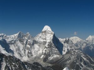
Is Mount Everest Still Growing Today?
Yes. Mount Everest continues to grow, and the reason is straightforward: The collision that built it has never truly stopped. The Indian Plate continues pushing north into the Eurasian Plate at a rate of approximately 4–5 mm per year, and that ongoing stress keeps lifting the Himalayas, together with Everest itself.
Scientists confirm this through the use of GPS measurements placed on and around the mountain. These GPS stations track tiny shifts in function and elevation over the years, and the statistics continuously show Everest growing by approximately 4 to 5 mm each yr. That would possibly sound small, but over hundreds of years, it adds up to a significant peak.
Earthquakes also play a role, even though not constantly throughout the course, as you would assume. Most tremors within the area cause the mountain to rise slightly because they release built-up tectonic stress by pushing the crust further upward. But some earthquakes can also cause a moderate drop in elevation, depending on how the fault below the surface shifts. The 2015 Gorkha earthquake, for instance, is believed to have altered Everest’s top by a small amount, although researchers are nevertheless refining specific figures.
So Everest is not a completed mountain. It’s an active geological structure, nevertheless responding to the identical forces that constructed it 50 million years ago.
Why Doesn’t Everest Grow Forever?
If Everest continues rising each year, why is it not hundreds of meters taller by means of now? The solution is erosion. While tectonic uplift pushes the mountain up, several erosional processes continuously wear it down, and the 2 strategies have roughly balanced each other out over geological time.
Here’s what works in opposition to Everest’s growth:
- Weathering breaks down uncovered rock via repeated temperature swings and chemical reactions with air and moisture.
- Wind erosion at excessive altitude strips away loose rock and sediment from uncovered ridges and faces.
- Freeze-thaw cycles are especially powerful at Everest’s altitude. Water seeps into cracks within the rock, freezes, expands, and slowly splits the rock apart. Repeat that cycle enough times, or even solid rock breaks down.
- Glacier erosion grinds away at the mountain’s surface as big ice sheets pass slowly downhill, wearing rock particles that scrape towards the terrain beneath them.
- Landslides and rockfalls get rid of massive chunks of material in a unmarried occasion, specifically after earthquakes loosen unstable slopes.
None of this means Everest is shrinking. Uplift from the continuing plate collision still outpaces erosion; that’s why the mountain continues to gain a few millimeters in height every year. But erosion is the reason. Everest hasn’t grown into something impossibly tall over 50 million years. It’s a consistent tug-of-war among forces pushing the mountain up and forces pulling it down.
How Old Is Mount Everest?
This question has two extraordinary answers, depending on what you are simply asking about: the rock or the mountain.
The rock is a whole lot older than the mountain. The limestone near Everest’s summit was formed from sediment and marine life at the bottom of the Tethys Sea hundreds of millions of years ago, long earlier than the Himalayas existed. Some of this rock is predicted to be over 400 million years old.
The mountain itself is way more youthful. Everest, as a landform, a raised top status above sea level, only began to form when the Indian and Eurasian plates collided around 50 to 55 million years ago. Before that collision, there had been no mountain in any respect, simply ocean ground.
So when a person asks, “How vintage is Everest?” the sincere answer relies upon the query:
| What you’re asking about | Approximate age |
| The rock at the summit | Hundreds of millions of years old |
| Everest as a mountain (uplift began) | 50-55 million years ago |
| Everest’s current shape (still forming) | Ongoing |
This distinction subjects because it explains something that confuses a whole lot of humans: how can a mountain contain rock that is a long way older than the mountain itself? The rock was there long before Everest existed. The mountain is a landform created when tectonic forces uplifted that rock.
Why Is Everest the Highest Mountain in the World?
Several elements combine to make Everest the tallest mountain on Earth, and it is not just about one single purpose.
Continued tectonic uplift is the main driving force. The Indian Plate continues pushing into the Eurasian Plate, and that ongoing collision contributes to the height of the entire Himalayan range, including the protection of Mount Everest. Few other mountain ranges on Earth sit in an energetic collision zone this powerful.
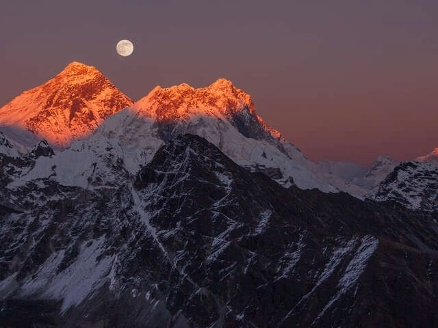
Himalayan geology also plays a role. The Himalayas were fashioned from continental plates crumpling together, which created an unusually thick crust. The thicker crust provides extra material available to push upward, which is part of why this range produces the tallest peaks in the world, such as 8,000-meter giants like Lhotse, Makalu, and Cho Oyu near Everest itself. You can spot numerous of those peaks collectively from viewpoints along the Gokyo Renjo La Pass Trek.
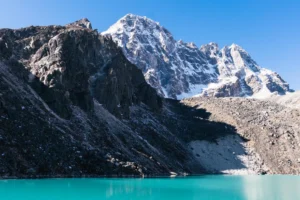
Relative erosion matters too. Everest’s summit sits in extraordinarily cold, dry situations with limited glacier habitat directly at the peak as compared to the lower slopes. That means erosion works on it more slowly than it does on mountains in wetter, warmer climates, letting more of the uplift “stick.”
One rationalization is really worth making: the highest above sea level doesn’t mean the tallest typical. Mauna Kea in Hawaii, measured from its base on the sea floor to its summit, is actually taller than Everest in overall height. Everest, in reality, reaches the best point above sea level of any mountain on Earth, which is the standard maximum human beings suggest when they call it the “tallest.”
What Scientists Have Learned From Mount Everest
Everest is not just a trekking destination or a climbing destination. It’s also one of the most studied geological sites on the Earth, and researchers have used it to understand processes that go a long way beyond one mountain.
Plate tectonics, as a scientific concept, gained its primary guidance from the Himalayas. The variety supplied clear, huge-scale proof of continental collision at a time when the theory was still being debated within the mid-20th century.
Continental glide research is predicated heavily on data from this place, too. By studying the rock layers and fault lines within the Himalayas, geologists had been able to reconstruct how India moved throughout the globe over hundreds of millions of years, before it ever touched Asia.
Climate history is another area in which Everest’s rock offers clues. The limestone and marine sediment close to the summit hold information about ocean conditions from hundreds of thousands of years ago, giving scientists a window into Earth’s climate long before human beings existed.
Earth’s evolution greatly benefits from ongoing studies here. GPS monitoring stations near Everest help to tune plate motion in real time, supporting scientists to refine models of the way mountain ranges develop, how earthquakes increase stress, and how erosion and uplift interact over long timescales.
In brief, Everest works as a form of open-air laboratory. Every layer of rock climbers’ footsteps beyond the way to Everest Base Camp incorporates a record of tectonic activity that scientists are still actively reading today.
FAQs
How was Mount Everest formed?
Everest formed when the Indian Plate collided with the Eurasian Plate around 50 to 55 million years in the past. Neither plate should sink below the other, so the crust between them folded upward, forming the Himalayas and Everest along with them.
What tectonic plates formed Mount Everest?
The Indian Plate and the Eurasian Plate. Their collision, which continues today, constructed the whole Himalayan range.
How old is Mount Everest?
The rock at the summit is hundreds of thousands of years old. The mountain itself, as a raised landform, started forming about 50 to 55 million years ago.
Why are seashells found on Mount Everest?
The summit’s limestone formed on the floor of the historic Tethys Sea. When tectonic collision drives that seafloor rock upward, marine fossils like shells, trilobites, and crinoids are preserved in conjunction with it.
Is Mount Everest still growing?
Yes. The Indian Plate continues pushing north, and GPS measurements show Everest rising approximately 4 to 5 mm every year.
Was Mount Everest once underwater?
Yes. The rock at its summit was formed underwater in the Tethys Sea long before the Himalayas existed.
Is Everest the tallest mountain on Earth?
It’s the highest above sea level. Measured base to summit, Hawaii’s Mauna Kea is surely taller, even though most of it sits underwater.