Nepal holds the world’s largest concentration of the planet’s tallest mountains. Eight of the fourteen 8,000-meter peaks on Earth stand inside Nepal’s borders or alongside its shared frontier with Tibet, giving this single country more exquisite and high-altitude terrain than anywhere else on this planet. These mountains have shaped current mountaineering records, transformed remote Sherpa villages into world-famous trekking destinations, and shaped how the world views Nepal today.
Nepal formally acknowledges fourteen peaks above 8,000 meters within or along its Himalayan territory. This range matches, but doesn’t exactly overlap with, the across-the-world recognized list of the arena’s fourteen 8-thousanders, because Nepal’s listing consists of extra named summits like Kanchenjunga Central, Kanchenjunga South, Yalung Kang, Lhotse Middle, and Lhotse Shar, which climbers frequently rely on as subsidiary peaks of their determined mountains rather than standalone eight-thousanders. Both counts rely, and this manual addresses both.
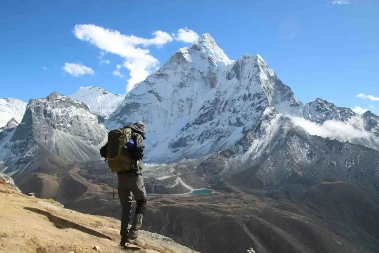
Each peak covered here has its very own geography, climbing history, and cultural weight. Some upward push directly above famous trekking routes. Others sit in far-flung valleys that see only a handful of expeditions every year. The sections under walk-through, where every mountain stands, what makes it awesome, and how you may enjoy it, whether or not on foot from a teahouse trail or on a technical hiking permit.
Nepal’s 14 Highest Mountains at a Glance
Nepal formally acknowledges fourteen peaks above 8,000 meters: eight the world over diagnosed 8-thousanders (Everest, Kanchenjunga, Lhotse, Makalu, Cho Oyu, Dhaulagiri I, Manaslu, Annapurna I) plus six subsidiary summits Nepal’s Department of Tourism introduced to its reputable height profile in February 2025 (Yalung Kang, Yalung Kang West, Kanchenjunga Central, Kanchenjunga South, Lhotse Middle, Lhotse Shar). The UIAA, the international governing body for mountain climbing, still recognizes only the classic eight as independent eight-thousanders internationally.
| Peak | Height (m) | Region | First Ascent | Border Status |
| Mount Everest | 8848.86 | Khumbu, Solukhumbu | 1953, Tenzing Norgay & Edmund Hillary | Nepal-China border |
| Kanchenjunga | 8586 | Taplejung, Kanchenjunga region | 1955, Joe Brown & George Band | Nepal-India border |
| Lhotse | 8516 | Khumbu, Solukhumbu | 1956, Ernst Reiss & Fritz Luchsinger | Nepal-China border |
| Makalu | 8463 | Makalu-Barun, Sankhuwasabha | 1955, Jean Couzy & Lionel Terray | Nepal-China border |
| Cho Oyu | 8201 | Khumbu | 1954, Herbert Tichy, Joseph Jochler, Pasang Dawa Lama | Nepal-China border |
| Dhaulagiri I | 8167 | Dhaulagiri, Myagdi | 1960, Swiss-Austrian-Nepali team | Entirely within Nepal |
| Manaslu | 8163 | Gorkha, Mansiri Himal | 1956, Toshio Imanishi & Gyalzen Norbu | Entirely within Nepal |
| Annapurna I | 8091 | Annapurna massif, Kaski/Myagdi | 1950, Maurice Herzog & Louis Lachenal | Entirely within Nepal |
| Yalung Kang | 8505 | Kanchenjunga range, Taplejung | 1973, Yutaka Ageta & Takeo Matsuda | Nepal-India border |
| Kanchenjunga South | 8476 | Kanchenjunga range, Taplejung | 1978, Wojciech Wroz & Eugeniusz Chrobak | Nepal-India border |
| Kanchenjunga Central | 8473 | Kanchenjunga range, Taplejung | 1978, Wojciech Branski, Zygmunt Heinrich & Kazimierz Olech | Nepal-India border |
| Lhotse Middle | 8410 | Khumbu, Solukhumbu | In 2001, the Russian team led by Sergei Timofeev | Nepal-China border |
| Lhotse Shar | 8400 | Khumbu, Solukhumbu | 1970, Sepp Mayerl & Rolf Walter | Nepal-China border |
| Yalung Kang West | 8077 | Kanchenjunga range, Taplejung | Unclimbed | Nepal-India border |
Where Are Nepal’s Highest Mountains Located?
Nepal’s fourteen 8,000-meter peaks cluster into 3 most important mountain structures, unfold across 5 districts in provinces.
The Kanchenjunga range holds five of the fourteen peaks: Kanchenjunga, Yalung Kang, Yalung Kang West, Kanchenjunga Central, and Kanchenjunga South. All five sit in Taplejung District, Koshi Province, directly on the Nepal-India border with Sikkim. This cluster forms the highest concentration of 8,000-meter terrain in Nepal.
The Everest-Lhotse massif in Solukhumbu District, also in Koshi Province, holds five more: Everest, Lhotse, Lhotse Middle, and Lhotse Shar rise from the same ridge system, whilst Makalu stands close by in neighboring Sankhuwasabha District. Everest, Lhotse, and Makalu all straddle the Nepal-China border with the Tibet Autonomous Region.
H3: Western Peaks and Trekking Access
The western cluster spreads throughout three separate tiers. Cho Oyu rises in Khumbu near the Tibet border. Dhaulagiri I stands in Myagdi District, entirely within Nepal. Manaslu rises in Gorkha District’s Mansiri Himal, also completely within Nepal. Annapurna I anchors the Annapurna massif among Kaski and Myagdi Districts, the easiest one of the 8 conventional peaks reachable via a hiking route that circles the whole mountain.
Six of the fourteen peaks stand exactly on an international border (Nepal-China or Nepal-India), at the same time as 3 (Dhaulagiri I, Manaslu, Annapurna I) thrust upward totally on Nepali soil. This geography also explains why some expeditions require a Chinese liaison alongside a Nepali one, especially on Everest, Lhotse, Makalu, and Cho Oyu’s northern routes.
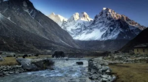
Trekkers trying to face close to those major peaks without a mountaineering guide have 3 realistic base areas to choose from: the Kanchenjunga region for the 5 jap peaks, the Khumbu valleys for Everest, Lhotse, and Cho Oyu, and the Annapurna region for Annapurna I and its neighboring 7,000-meter peaks. Makalu sits barely apart, reaching through its very own committed valley at the Makalu Base Camp Trek.
The 14 Peaks: Everest, Kanchenjunga, Lhotse, and Makalu
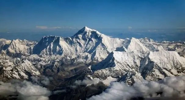
Mount Everest (8,848.86 m)
The international’s most famous mountain, growing on the Nepal-China border in Solukhumbu District. Tenzing Norgay and Edmund Hillary made the primary ascent on May 29, 1953. Everest receives the highest number of climbers of any 8,000-meter peak, with over 6,000 successful ascents since 1953. The standard South Col path starts offevolved from Everest Base Camp, reached through the classic 12-14 day Everest Base Camp Trek through Namche Bazaar and Tengboche. As of the 2025 season, the fee is USD 15,000 for spring climbs, solo expeditions are banned, and each climber has to be observed by means of at least one licensed manual.
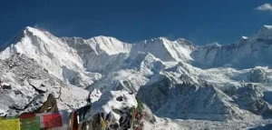
Kanchenjunga (8,586 m)
The international’s third-highest peak, sitting at the Nepal-India border in Taplejung District. Joe Brown and George Band completed the first ascent on May 25, 1955, intentionally short of the genuine summit out of respect for Sikkimese ideals that consider the peak sacred. Kanchenjunga is far less crowded than Everest and is recognised for its technical southwest face direction up the Yalung Glacier. Trekkers can reach Kanchenjunga’s base camps on our Kanchenjunga Trek without having a hiking permit.
Lhotse (8,516 m)
The world’s fourth-highest mountain shares its decreasing slopes and Western Cwm method with Everest. Ernst Reiss and Fritz Luchsinger made the primary ascent on May 18, 1956. Because Lhotse’s standard route follows the same path as Everest’s South Col path before branching off at the Yellow Band, many climbers attempt both peaks in the same season, a feat known as the “Double Crown,” which is completed within 24 hours.
Makalu (8,463 m)
The global 5th-highest peak, rising in Sankhuwasabha District close to the Tibet border. Jean Couzy and Lionel Terray made the first ascent on May 15, 1955. Makalu’s 4-sided pyramid shape makes it one of the more technically demanding eight-thousanders, with steep ridgelines and restricted smooth routes. The Makalu Base Camp Trek offers near perspectives of the height through one of Nepal’s least-crowded valleys.
Cho Oyu (8,201 m)
The world’s 6th-highest mountain, rising in Khumbu close to the Nepal-China border. Herbert Tichy, Joseph Jöchler, and Pasang Dawa Lama made the primary ascent on October 19, 1954. Cho Oyu is widely taken into consideration the most approachable of the eight-thousanders, with a slight northwest ridge direction and fewer technical obstacles than Everest or Lhotse, which is why many climbers select it as their first 8,000-meter summit.
Dhaulagiri I (8,167 m)
The international 7th-most peak, completely inside Nepal, in the Myagdi District. Its call comes from Sanskrit phrases meaning “white mountain.” A Swiss-Austrian-Nepali crew, such as Kurt Diemberger, Peter Diener, Nawang Dorje, and Nima Dorje, made the primary ascent on May thirteen, 1960. Dhaulagiri’s northeast ridge direction is technically serious, and the mountain is known for unexpected, extreme weather changes, even with the aid of Himalayan requirements.
Manaslu (8,163 m)
The 8th-highest mountain in the world, growing in Gorkha District’s Mansiri Himal, is absolutely inside Nepal. Toshio Imanishi and Gyalzen Norbu made the primary ascent on May nine, 1956, giving the peak deep significance in Japanese climbing records. Manaslu is regularly recommended as a popular introductory peak into 8,000-meter mountain climbing, with a nicely established ordinary course and a growing hiking path to its base camp.
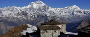
Annapurna I (8,091 m)
The internationally 10th-most-peaked and the historically significant of all fourteen: Maurice Herzog and Louis Lachenal made their first ascent on June three, 1950, making Annapurna I the first 8,000-meter peak ever climbed by people, 3 years before Everest. Despite being the shortest of the 8 traditional 8-thousanders, it incorporates one of the highest fatality rates of any peak in this peak magnificence because of frequent avalanches. The mountain rises in the Annapurna Conservation Area, Nepal’s biggest protected location at 7,629 square kilometers, accessible via our Annapurna Circuit Trek.
Yalung Kang (8,505 m)
The primary western summit of the Kanchenjunga massif, from time to time referred to as Kangchenjunga West, stands in Taplejung District on the Nepal-India border. Yutaka Ageta and Takeo Matsuda made the primary ascent on May 14, 1973. Yalung Kang is one of the six subsidiary peaks Nepal’s Department of Tourism formally introduced to its identified 8-thousander list in February 2025, even though the UIAA nonetheless classifies it as a subsidiary summit of Kanchenjunga as opposed to an independent peak.
Yalung Kang West (8,077 m)
A subsidiary summit of the Kanchenjunga massif in Taplejung District, ultimately unclimbed so far. It is the simplest one among Nepal’s fourteen officially diagnosed 8,000-meter peaks with no recorded ascent, making it one of the last unclimbed lines above 8,000 meters anywhere in the world.
Kanchenjunga Central (8,473 m)
One of Kanchenjunga’s five summits, rising at the Nepal-India border in Taplejung District. A Polish team of Wojciech Brański, Zygmunt Heinrich, and Kazimierz Olech made the first ascent on May 22, 1978. This ascent, at the side of Kanchenjunga South’s first ascent 3 days in advance, completed the traverse of all of Kanchenjunga’s principal summits within a unmarried excursion season.
Kanchenjunga South (8,476 m)
Another of Kanchenjunga’s summits, standing beside Kanchenjunga Central on the Nepal-India border. Wojciech Wróż and Eugeniusz Chrobak, also part of the 1978 Polish expedition, made the first ascent on May 19, 1978.
Lhotse Middle (8,410 m)
A summit on the Lhotse-Everest ridge system in Solukhumbu District, notable for being the remaining 8,000-meter peak on Earth to be climbed. A Russian team led by Sergei Timofeev made the primary ascent on May 23, 2001, a technically demanding traverse along a narrow, corniced ridge.
Lhotse Shar (8,400 m)
The easternmost summit of the Lhotse massif is also in Solukhumbu District. Austrian climbers Sepp Mayerl and Rolf Walter made the primary ascent on May 12, 1970. Lhotse Shar sees a long way fewer expeditions than its neighboring peaks because of a steep, avalanche-prone south face.
Which Peaks Can You See Without Climbing?
Trekkers can see all fourteen peaks up near without a climbing permit, simply by way of deciding on the proper hiking direction.
- Everest, Lhotse, Lhotse Middle, and Lhotse Shar: seen from Kala Patthar and Everest Base Camp on the same old EBC trek, with the clearest perspectives at dawn from Kala Patthar’s 5,644-meter standpoint.
- Kanchenjunga, Yalung Kang, Yalung Kang West, Kanchenjunga Central, and Kanchenjunga South: all come into view from Pangpema (North Base Camp) or Oktang (South Base Camp) on the Kanchenjunga Trek, considered one of Nepal’s least crowded extreme routes.
- Makalu can be seen from Makalu Base Camp and the Shipton La bypass on the Makalu Base Camp Trek.
- Cho Oyu: can be seen from Gokyo Ri and the Renjo La pass inside the Khumbu location, frequently combined with EBC on longer itineraries.
- Dhaulagiri I: visible from the Dhaulagiri Circuit and French Pass, and distantly from Poon Hill at the Annapurna aspect.
- Manaslu comes into complete view from Larkya La on the Manaslu Circuit Trek and from several ridgelines close to Samagaon.
- Annapurna I can be seen from Annapurna Base Camp itself, and more distant from Poon Hill, each reachable on the Annapurna Circuit Trek.
No single trek indicates all fourteen peaks. Anyone wanting to pursue more than one degree in one ride needs to plan separate expeditions to the Eastern, relevant (Khumbu), and western (Annapurna/Manaslu/Dhaulagiri) regions, or contact our group to build a multi-place itinerary.
Hardest Mountains to Climb Among Nepal’s 14 Peaks
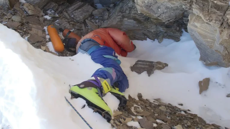
Annapurna I ranks as Nepal’s most dangerous 8,000-meter peak by way of fatality rate. Its ancient fee has run as high as 32%, even though improved forecasting and route know-how have brought the cutting-edge-technology rate down to roughly 13%. Annapurna I’s fatality fee exceeds Everest’s by way of a wide margin, as the Himalayan Database confirms. The danger comes from unavoidable avalanche corridors on its most important routes, not from climber mistakes.
Kanchenjunga follows, with a fatality rate anticipated between 12% and 22% depending on the dataset used, pushed by intense remoteness and excessive weather exposure at altitude.
Dhaulagiri I includes a fatality charge within the 15-21% range. No climber has ever reached the summit through its southern face, and even Reinhold Messner failed on that course.
Makalu sits lower on the hazard scale at roughly 9-13%; however stays technically annoying because of its steep, 4-sided pyramid shape and thin ridgelines with few limited escape options.
By assessment, Cho Oyu and Manaslu are broadly considered Nepal’s most approachable 8-thousanders for climbers building in the direction of harder peaks, with fatality quotes underneath 6% and well-established commercial routes.
Key takeaway: among Nepal’s fourteen recognized peaks, difficulty does not scale neatly with height. Annapurna I, the shortest of the 8 classic 8-thousanders, is statistically the most dangerous, while Cho Oyu and Manaslu, both taller, are taken into consideration as access factors into 8,000-meter mountaineering.
Interesting Facts About Nepal’s 14 Highest Peaks
- Annapurna I, no longer Everest, was the first to be climbed. Maurice Herzog and Louis Lachenal reached the summit in 1950, 3 years before Everest, making it the primary 8,000-meter peak ever climbed by humans.
- Yalung Kang West stays unclimbed. It’s the simplest, considered one of Nepal’s fourteen formally diagnosed 8,000-meter peaks with no shown ascent, making it one of the final unclimbed 8,000-meter peaks on Earth.
- Lhotse Middle was the last 8,000-meter summit climbed everywhere inside the international, not reached till 2001, almost half a century after Annapurna I.
- Everest’s summit height changed in 2020. A joint Nepal-China survey confirmed the legitimate peak at 8,848.86 meters, revising the long-used 8,848-meter determination that had stood since 1954.
- Kanchenjunga’s 1955 first ascent crew stopped simply short of the genuine summit out of respect for Sikkimese non-secular beliefs that recall the height as sacred, a tradition many climbers still follow these days.
- Six peaks have been brought to Nepal’s authentic listing in February 2025: Yalung Kang, Yalung Kang West, Kanchenjunga Central, Kanchenjunga South, Lhotse Middle, and Lhotse Shar, all subsidiary summits of Kanchenjunga and Lhotse.
- Annapurna I has the very best fatality rate of any 8,000-meter peak on Earth, traditionally as high as 32%, in spite of being the shortest of Nepal’s eight conventional eight-thousanders.
- Reinhold Messner was the first person to summit all fourteen original eight-thousanders, finishing the feat in 1986 without supplementary oxygen, along with six of Nepal’s conventional peaks.
FAQs
How many 8,000-meter peaks does Nepal have?
Nepal formally recognizes fourteen peaks above 8,000 meters, following the Department of Tourism’s February 2025 update that added six subsidiary summits (Yalung Kang, Yalung Kang West, Kanchenjunga Central, Kanchenjunga South, Lhotse Middle, Lhotse Shar) to the 8 across the world identified 8-thousanders already inside Nepal.
How many of the world’s 14 eight-thousanders are in Nepal?
Eight of the fourteen internationally identified eight-thousanders stand in Nepal or on its border: Everest, Kanchenjunga, Lhotse, Makalu, Cho Oyu, Dhaulagiri I, Manaslu, and Annapurna I. The last six sit in Pakistan (5) and China (1).
Which Nepal peak is the most dangerous to climb?
Annapurna I holds the best fatality rate amongst Nepal’s fourteen peaks, traditionally as high as 32%, even though the contemporary-era rate has fallen to around 13%.
Which 8,000-meter peak in Nepal is unclimbed?
Yalung Kang West (8,077 m), a subsidiary summit of the Kanchenjunga massif, remains the only one of Nepal’s fourteen recognized peaks without a recorded ascent.
Can you trek to see these peaks without a climbing permit?
Yes. All fourteen peaks can be seen from established trekking routes, together with Everest Base Camp, the Kanchenjunga Trek, the Makalu Base Camp Trek, and the Annapurna Circuit, none of which require a climbing permit.
What is the best time of year to climb in Nepal?
Spring (April-May) is the peak trekking season, with autumn (September-October) serving as a secondary climbing season, particularly for Manaslu and Cho Oyu.
Why does Nepal have so many 8,000-meter peaks?
Nepal sits along the collision zone between the Indian and Eurasian tectonic plates, where ongoing continental collision has pushed the Himalayas to the greatest heights of any mountain range on Earth, creating the world’s greatest concentration of high-altitude terrain.
For customized ride planning throughout any of these regions, reach out to Nepal Outdoor Expeditions.
Plan Your Himalayan Journey
Nepal’s 14 8,000-meter peaks represent more than a checklist of the world’s highest peaks. Each peak has its own geography, climbing history, and cultural significance. Annapurna I became the first 8,000-meter peak ever climbed, while Yalung Kang West is still one of the last unclimbed summits on Earth.
Whether your goal is a technical expedition or a trek that offers views of these summits without a climbing permit, choosing the right route depends on the season and your experience level. Our team has guided trekkers and climbers across all three major mountain clusters. These include the remote Kanchenjunga valleys, the busy Khumbu trails, and the accessible Annapurna Circuit.
Explore our complete variety of treks and expeditions, beginning with the Kanchenjunga Trek, the Makalu Base Camp Trek, or the Annapurna Circuit Trek, or get in touch with our crew to build a custom itinerary around any of Nepal’s fourteen highest peaks.